


Help
Community21 has selected some case study communities and projects to share across the network to inspire and inform others. Should we be featuring yours? If so get in touch.
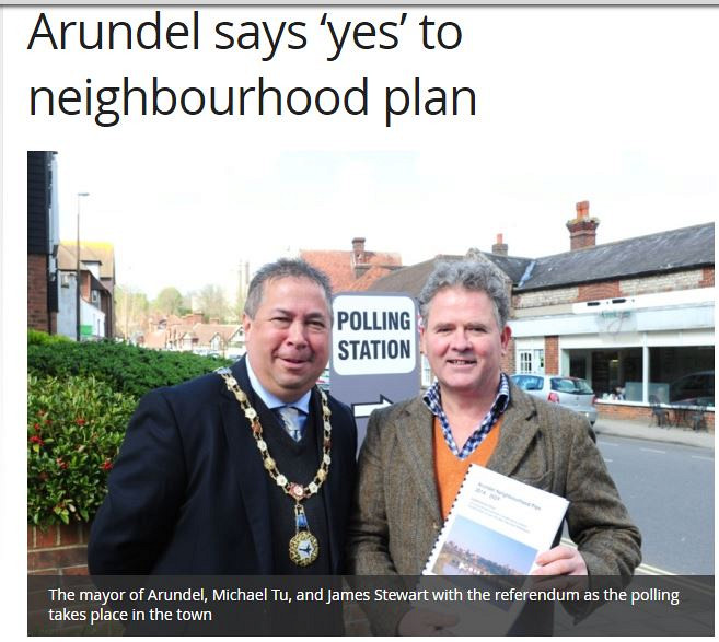
The Arundel Neighbourhood Plan is now adopted and forms part of the statutory Development Plan for Arundel
Arundel civil parish occupies exceeding its built-up clusters which are in two halves, old towards the north and new to the south, past a main road.[2]
Arundel town is a major bridging point over the River Arun as it was the lowest road bridge until the opening of the Littlehampton swing bridge in 1908. Arundel Castle was built by the Normans to protect that vulnerable fairly wooded plain to the north of the valley through the South Downs. The town later grew up on the slope below the castle to the south.[7] The river was previously called the Tarrant and was renamed after the town by antiquarians in a back-formation.
Arundel includes meadows to the south but is clustered north of the A27 road, which narrowly avoids the town centre by a short and congested single carriageway bypass. Plans for a more extensive, HQDC bypass were debated intensely between 1980 and 2010 and built a junction for it at Crossbush. Arundel railway station is on the Arun Valley Line. The Monarch's Way long-distance footpath passes through the town and crosses the river here, while just under five miles north and north-west of the town the route of the South Downs Way runs.
Since 1 April 2011 the town has been within the boundaries of the South Downs National Park.
source: wikipedia
What is a Neighbourhood Plan A Neighbourhood Plan is a plan that can set out where development will go and what development could look like in a particular area. The production of our Plan will be led by the Town Council but it needs the involvement of the local community. There is no requirement for us to make a Neighbourhood Plan, however the Plan will be used by Arun District Council to help make decisions on planning applications received in our community. It will form part of the Planning Framework for the District and sit alongside the Local Plan which Arun is producing that sets out policies and proposals to do with strategic issues. There are a number of legal requirements that a Neighbourhood Plan has to go through before it can be used to make planning decisions by the District Council. Once it has met all these requirements and been tested it can be adopted by the District Council and used in planning decisions


Comments